Warming up After a Winter Whiplash

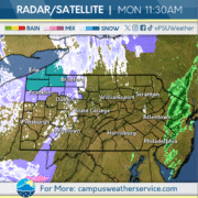
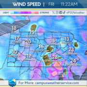
This week started out particularly wintry for early November. Much of the Commonwealth saw snow showers, temperatures below freezing, and strong winds.

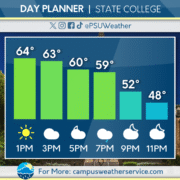
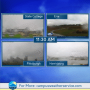
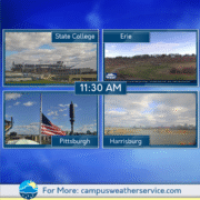
However, today is looking to be more seasonable, with temperatures in the high 40s. While still windy, winds are expected to die down significantly by tomorrow. There will be times of clouds and sun to close out the week.

Looking ahead, it’s expected to warm up to the mid 50s for the start of the weekend, with rain possible Saturday. Another cool down may be in store for the start of next work week, with freezing temperatures and lake effect snow back on the table.
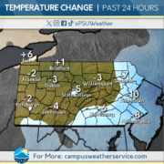
Slight Warm-Up, Still Chilly

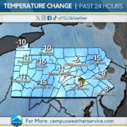
Yesterday saw frigid temperatures across the Commonwealth, with temperatures failing to get out of the 30’s in State College. Cold enough temperatures led to some lake effect snow bands progressing across the western and central parts of the state, bringing many places their first snowfall.

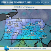
Today, we should not expect those frigid temperatures, with a slight warmup expected. However, temperatures will still be noticeably below average for this time of year. Wind is also a factor, making wind chill temperatures dip into the 30’s, and even the 20’s, in many spots.

Tomorrow, temperatures will hover around average with partly cloudy conditions while staying dry. We can expect similar conditions, with our next rainmaker approaching as we head into the weekend on Saturday.

Lake-Effect in Effect!

It has been quite the chilly start to our week here in Pennsylvania! Average highs being in the 40’s and lows in the 30’s. The Northwest corner of the Commonwealth has experienced its first snowfall from Lake-effect off of Erie. This banding has reached portions of Central Pennsylvania, but so far has not left much accumulations.

For today, chances of snow are still likely with very windy and blustery conditions. For tonight, snow will continue to appear on the radar due to Lake-effect and will impact much of the Western half of the state. For tomorrow, temperatures will begin to raise above freezing, with chances of rain in the evening to overnight hours.

To end the work week, that low pressure system causing rain will clear out and much more moderate conditions will take over. Into the weekend, we will experience plenty of sunshine and warmer conditions.

Wintry Mess Across the Commonwealth

Autumn held strong this weekend, with Saturday staying relatively mild and precipitation-free across the Commonwealth. Unsettled conditions appeared once again in conjunction with a cutoff low pressure system on Sunday, with periods of rain occurring after midday in some areas.

Our low has settled in to our west, and conditions have become more winter-like. Flurries originating from lake-effect snow showers have been noted across the western half of the Commonwealth this morning, accompanied by a breeze. The Erie region, along with the highest elevations, can expect some accumulation and perhaps some travel troubles. However, most will not see anything stick.

Tuesday will be very similar as our low lingers, with sub-40s daily high temperatures and a cold breeze alongside occasional weak snow showers. Wednesday will be more mild as the low exits, though a breeze will remain along with mostly cloudy skies. Much more pleasant conditions can be expected past then, with skies clearing and mild temperatures setting back in.

Rain & Clouds

This past week was plagued by wind and rain, most notably a front passing through Central Pennsylvania this past Wednesday. The frontal passage brought 50 mile per hour wind gusts here in State College, and gusts into the 60 mile per hour range elsewhere.


Today will start off cloudy and breezy, with rain chances developing over the course of the afternoon and spiking around dinner time tonight. You can expect am organized band of showers to push through the area around 8pm tonight.


Looking ahead to the Penn State football game this Saturday, nice and dry albeit a little chilly. Sunday will see another front move through that will increase wind gusts and bring rain chances to start off next week.

Weather Whiplash

After last night’s rain and wind, the Commonwealth will see cool and dry conditions today. Skies will be mostly cloudy, with winds continuing to gust around 30 MPH.

Tomorrow, another round of rain will invade the region, with periods of showers expected Friday afternoon and evening. Temperatures will rise above average again heading into the weekend.

Looking ahead, periods of clouds and sun are expected this weekend. More showers are possible Sunday before a major cool down for the start of the next work week, with the threat of wintry precipitation possibly on the table Monday night into Tuesday.

Cold Front Approaches

Election day yesterday brought windy conditions and a high of 57 degrees and a low of 36 degrees. Sunny conditions persisted through the day yesterday, with clear conditions at night as well. Wind gusts were from 25 to 30 miles per hour.

Todays weather will bring more wind gusts from 35 to 45 miles per hour. The high today will be 67 degrees which is about ten degrees higher than the average for this time of year. a cold front will be coming in tonight to State College, bringing cooler temperatures and a few quick showers.

Temperatures will be significantly cooler than today, with a highs in the upper 40s. There will be partly cloudy conditions and more wind gusts throughout the day. Temperatures for this weekend will rebound to the upper 50s.


Staying Dry, Warmer Temps

Yesterday, we stayed dry with lots of sunshine coming through, with temperatures reaching the lower 60s, which is above average for this time of year.

Today, temperatures won’t reach the 60s, but rather will remain average for this time of year. Cloud coverage is expected to increase throughout the afternoon, clearing up by the evening.

Tomorrow, we will continue to remain around average, with clear and sunny skies. Looking forward to Wednesday, temperatures will return to above average, reaching the low 60s once again and a chance of showers overnight.

Windy and Spooky Start to the Weekend

A low pressure system moving through the region brought heavy rain on Thursday. Some areas of the Commonwealth even experienced thunderstorms during the evening hours. The system left behind lower temperatures and windy conditions to start off Halloween.

Wind advisories remain in effect for much of the state on Friday. A few showers will linger during the morning and afternoon as the system moves out of the area. Halloween night will be quite chilly and breezy, although conditions will remain relatively dry.

The start of November will be seasonable with mostly clear conditions during the weekend. Wind will begin to taper off throughout the next few days. The beginning of next week will see the next chance for rain, as another low pressure system could bring some showers to the Eastern part of the Commonwealth.

Cool and Rainy Across the Commonwealth

The Commonwealth has seen cool, rainy conditions over the past 24 hours. The region has seen periods of rain, sometimes heavy, bringing a few inches of much-needed rain.

Over the next day or two, rain will clear out over to our north and east, and mostly cloudy conditions will take its place. Temperatures will return to a few degrees below average.

Looking ahead, the weekend will see seasonable temperatures and times of clouds and sun. The start of the next work week will bring warmer temperatures, but also multiple opportunities for precipitation.