
CWS Forecast: Ridge and Valley Region
A somewhat muggy, more unsettled pattern will continue across much of central Pennsylvania Thursday, with considerable cloud cover and a few afternoon showers and storms possible before conditions turn slightly cooler and less humid Friday. Saturday kicks of the weekend with an unsettled pattern, featuring periodic clouds, scattered showers or thunderstorms, and temperatures fluctuating around the mid 70s. A warmer and more humid feel then redevelops starting Sunday, with partly sunny skies and highs around the low 80s beginning the work week, although afternoon showers and storms cannot be ruled out.
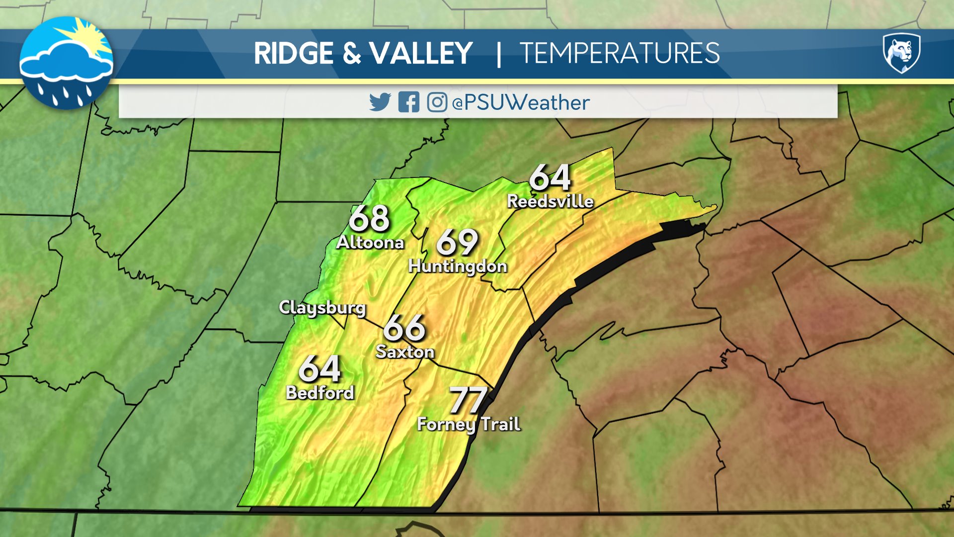
Day One: Thursday, September 10th 2026
Cloudy skies in the morning give way to mostly cloudy skies in the afternoon. Rounds of showers develop into the evening and continue overnight before beginning to taper off in the late.
High: 79°F
Low: 61°F
Day Two: Friday, September 11th 2026

Mostly sunny skies throughout the day as drier air takes hold. Skies remain mostly clear into the overnight.
High: 75°F
Low: 58°F
Day Three: Saturday, September 12th 2026

Moisture returns as clouds build and persist during the day with increasing shower chances. Periods of rain, with a heavy shower possible, continue into the night.
High: 72°F
Low: 65°F
Day Four: Sunday, September 13th 2026
Cloudy in the morning, then partly cloudy skies emerge into the afternoon. Mostly clear skies after dusk.
High: 80°F
Low: 62°F
Day Five: Monday, September 14th 2026

Partly to mostly cloudy during the day and into the nighttime hours.
High: 80°F
Low: 63°F

