Colossal Cold Continues

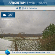
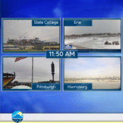
The past 24 hours have seen frigid temperatures across the Commonwealth, with temps in the single digits and teens in Central Pennsylvania. Conditions have been mainly dry, with times of clouds and sun.

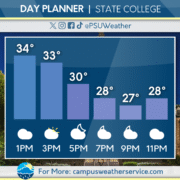
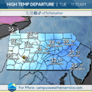
For today, temperatures will be a bit more seasonable, with highs topping out closer to climatological average. The region will see a chance of snow showers that could produce some minor accumulation later today into tomorrow.

Looking ahead, a large-scale winter storm threatens to invade the Commonwealth late this weekend, bringing with it the possibility of significant snowfall. With that, it is looking increasingly likely that the weekend will be historically cold, with temperatures struggling to make it out of the single digits.
Chilly is the Theme of the Week!

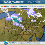
It has been very chilly recently with average temperatures in 20s for much of the Commonwealth this past weekend. In the northern tier, some locations even experienced single-digits in the overnight hours and teens in the central to southern half of the state. On Monday, the Northwestern portion of the state experienced some snowy conditions as a smaller system made its way across the area.

For this week, those chilly trends will continue, with the average lows in the mid-20s and highs in the mid-30s. Tonight, a system will start to head into our area creating a chance of precipitation throughout the Commonwealth on Wednesday. Areas in the northern half of the state as well as the higher elevations will experience mostly snow, whereas lower elevations and more southern regions will most likely experience a mix of precipitation. This system should clear out of our area early Thursday morning leading to a mostly cloudy day.

Heading into the weekend, another small system will come into our area from the west creating chances of snow on Friday, as well as possibly on Saturday and Sunday.

Chilly Conclusion to the Week

Temperatures have trended downward over the last few days, settling into the lower teens overnight.  Following the significant snowfall earlier in the week the skies have remained overcast.  Thursday was another gusty day around the area with winds topping out around the 30 mph.

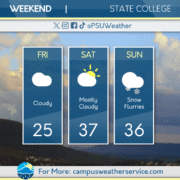
The start to Friday had lows in the single digits, making conditions around the area quite frigid to start the weekend.  Cloudy skies will be the case throughout much of the day on Friday.  There will be no chance for measurable precipitation during as the weekend begins.

The temperature will start to warm back up into the mid 30s on Saturday.  Conditions will stay dry all day and overnight into Sunday morning.  Sunday will see the next chance for a wintry mix to move through the area.

Frozen Friday on the Way

The Commonwealth saw its first plowable snowfall on Tuesday, with most of the Commonwealth seeing 2-6″ of snow. The past few days have been cloudy and cold, and temperatures will continue to drop heading into tonight.

Temperatures are looking to drop into the single-digits and teens tonight as frigid air invades from the north. Expect cloud coverage to increase throughout the day on Friday.

Expect skies to remain mostly cloudy over the weekend, as a clipper system moves into the area late on Sunday bringing snow and rain to parts of Pennsylvania. After that, expect a break from precipitation on Monday before another system moves in on Tuesday.

Frigid Conditions On The Way

Yesterday brought overcast conditions across the Commonwealth following a system that dropped 3.0″ of snow in State College. Temperatures were primarily at or below freezing for most of the state.

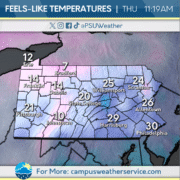
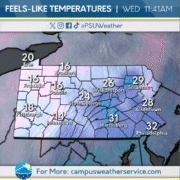
Today will continue to bring below average temperatures across the Commonwealth, with feels like temperatures falling into the teens across many of the Western portions of state. Conditions will remain overcast for the first half of the day, with some clouds breaking up as we head into the evening.

Tomorrow will remain below average temperature wise, with a slight chance of snow showers in the Western portions of the state. The main story as we head into the end of the week and into the weekend is the temperatures. High temperatures will be below freezing for most of the Commonwealth, with low temperatures in the single digits, and feels like temperatures below zero.

Snow is on the Way!

We have been experiencing generally cloudy skies and below average temperatures due to a trough over the area.  Temperatures have been in the 30s for the past several days, with gusty winds making wind chills even lower.

Today we expect to see temperatures in the 30s across most of the state with mostly cloudy skies, with slightly warmer conditions in the southeastern parts of the state.  Light winds are expected across most of the Commonwealth ahead of our next wintry system that arrives late at night.

Tomorrow snow is expected to move across the state from west to east during the early morning hours.  Places north and west of I-78 are likely to see snow for the entirety of the storm with 2-4 or more inches of snow expected, while southeastern Pennsylvania will see a brief thump of snow before a transition to a mix and eventually rain by the late morning hours.  The storm should exit the state by the evening hours.  After the storm, below average temperatures are expected across the state throughout the rest of the week.

Above Average End to the Week

Thursday saw more gloomy conditions around the Commonwealth, as fog overtook the area throughout much of the day. Temperatures remained chilly during the morning and afternoon, with highs barely reaching above the 40s.

For Friday, the clouds return and making an appearance, above average temperatures. Highs in the low 50s for much of Centre County are expected and we will stay on the dry side until this evening when rain showers become possible.

Looking ahead to this weekend, mostly cloudy turning into sunny skies by the afternoon. Sunday will see temperatures much like Friday in the low 50s and free of rain.

Cloudy Skies and Seasonable Temps

Much of the Commonwealth saw some serendipitous snowfall Tuesday night into Wednesday, complicating the morning commute on Wednesday. Otherwise the weather has been cold with times of clouds and sun.

As for today, conditions will be cloudy, with temperatures a few degrees below average. Tomorrow, conditions remain cloudy, with temperatures warming to a bit above average. There is a chance of occasional showers tomorrow.

Looking ahead to the weekend, the Commonwealth is looking to see times of clouds and sun with temperatures in the mid-upper 40s. As for next week, multiple rounds of rain look to threaten the region.

Snowy State College

Last night we saw a quick system move throughout State College, bringing rain early that eventually switched over to snow, around 2:30am. Snowfall accumulations here at Penn State were around 1.5″, with locally heavier amounts around Centre County.

The snow has since exited our region, with cloud coverage sticking around for the rest of the day, but remaining dry. Temperatures will remain below average, sitting in the low 40’s for our high temperature.

For the rest of the week, we can expect temperatures to rebound into the mid 50’s come Friday, above average for this time of year. Our next chance for precipitation will arrive this Saturday, with models hinting at rainfall early in the morning.

Lake Effect Snow in Affect

The Lake Effect Snow machine has been firing on all cylinders for the past couple of days. Peaking with a snow band stretch over 800 miles on Sunday and causing flurries to fall all across the Midwest and Northeast. Temps rebounded to the 40s range, with locations across Pennsylvania seeing temperatures higher than what they saw to start last week.


Today will bring flurries falling sporadically all day as Lake Erie will pump out Lake Effect Snow for most of the day. In addition to snow, expect gusts to be howling near 30 miles per hour here in State College. Keep an eye on the feels like temperature as it will drop to well under what the actual temperature is.


Looking ahead to the next couple of days, a chance for precipitation is present for Tuesday, before clearing out leaving Wednesday clear but chilly. Chance of showers returns by Thursday night and carries over into the weekend till Sunday when conditions clear up again.