A Quiet Week, Warmth on the Way!

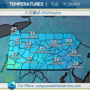
Tuesday brought well below average temperatures and snow squalls to the Commonwealth. Temperatures were hovering in the 30s, with lows across Western Pennsylvania dropping into the teens as clouds began to clear and winds became calm.

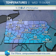
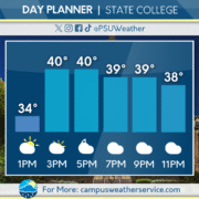
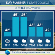
Wednesday will feature rising temperatures, with highs closer to seasonal for mid march. Today will remain dry, with some upper level cloud cover. Most snow that remains across Central and Western PA will melt off throughout the day.

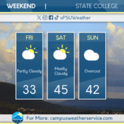
The rest of this week will feature rising temperatures. Some rain and snow showers are possible Thursday night, before 50s and 60s return for the weekend.

Lucky or Unlucky Temperatures?

After spring-like and stormy conditions yesterday, a cold front moved through the Commonwealth overnight. The front brought with it a sharp drop in temperatures and mixed precipitation, leading to slick road conditions. Parts of the state picked up minor accumulations and gusty winds caused feels like conditions to plummet.

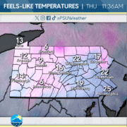
St. Patrick’s Day is a chilly day across the Commonwealth, with feels-like temperatures barely climbing above the teens. Gusty conditions remain with scattered snow showers possible throughout the day. Clouds will begin to clear out of the region during the evening and overnight hours.

Wednesday will see a break from the wet weather pattern. Sunny skies will be the case for the majority of the Commonwealth, and winds will remain light throughout the day and night. Chances for rain will return to the region later in the week as temperatures begin to increase for Pennsylvania.

Severe Weather Today

A prominent cold front is currently moving across the Commonwealth, bringing a line of potentially severe thunderstorms. Areas farther southeast are placed under a 3/5 severe storm risk, as issued by the Storm Prediction Center, with Central PA largely remain in a 2/5 risk. The largest severe threat will come in the form of damaging wind, although a few isolated tornadoes cannot be ruled out.

Following the departure of the cold front, temperatures will dip well below average, which will cause a change in precipitation type over to snow during the nighttime hours. Accumulations between 1-2″ across Central PA are expected, with higher totals in the northern tier. The morning commute could be treacherous from icy conditions due to below-freezing temperatures overnight.

Warm weather will slowly return as the week progresses, bouncing back above average by Thursday. Other than a few scattered snow showers, conditions are expected to remain dry through Friday.

Spring Warmth (and rain) Arrives

The Commonwealth seems closer than ever to escaping this very drawn-out winter pattern. While we got our first hints at Springtime temperatures last weekend, the following work week was not as kind, as temperatures hovered around the upper 30s and low 40s, and several rounds of rain passed through midweek.

Friday’s conditions feature a steep temperature gradient across the Commonwealth. A warm air mass is slowly rolling in, and while higher elevations in the eastern reaches may still be near freezing, regions in the west are currently seeing temperatures climb to the low-60s. Fog has held steady through the morning hours, covering a very large percentage of the state. When this burns off, another round of showers is possible in the afternoon, with clouds remaining into the night.

Saturday will see temperatures soar to near or at the 70 degree mark, alongside a bit more sun. This will precede another cold front, and with it, our first convective activity of the year. A line of showers and thunderstorms is expected to roll from one end of the Commonwealth to the other in the afternoon and evening. Temperatures will drop again to the mid-50s on Sunday, although we will finally see some more consistent sunshine, and can finally look forward to a fair weather pattern and above-average temperatures across the region.

It’s going to be a wet next couple days!

Recently, there have been above average temperatures with some rain. Yesterday, we had very mild and wet conditions, which has been consistent with the past few days. These conditions have allowed for any remaining snow to melt, which has led to extra wet and muddy conditions. This morning, we had some showers and well above average temperatures. Right now, we are seeing the wet and warm trend continue with rain and well above average temperatures. Tonight, we expect the showers to clear and lead to overcast conditions with the warm trend continuing. Over the next few days, we will see this warm and rainy trend continue with above average temperatures and rain tomorrow and then for Saturday, we expect some strong thunderstorms that could be on the severe side, with above average temperatures.

A Wet Week Continues

A wintry mess moved through the Commonwealth Tuesday, spreading snow, sleet, and freezing rain throughout the day. Areas of the central mountains picked up as much as 0.2″ of ice accretion. As the day went on, most areas outside of the higher elevations switched over to plain rain as temperatures increased.

Wednesday will feature cloudy skies and light mist and drizzle. Temperatures will rise above average again with most of the Commonwealth reaching the 50s for highs.

Another round of steady rainfall moves in on Thursday, with most regions of the Commonwealth picking up over a half inch of precipitation. This is much needed rainfall as the majority of Pennsylvania is currently under drought conditions. Rain will continue through much of the day, and could feature some isolated downpours. Keep the umbrella handy!

Warming Trend on the Way!☀️

Last night, a warm front brought some snow showers to the area leaving little to no accumulation. It also produced gusty winds, keeping conditions cooler into the overnight hours and into today.

Today in State College a few flurries remain from the system that passed through last night. Later today, clouds will mix with periods of sunshine and will remain dry for the rest of the day. Temperatures will stay seasonably chilly, with highs hovering in the low to mid 30s.

Looking ahead, another low-pressure system is set to move through midweek, bringing the chance for mixed precipitation. By the weekend, temperatures gradually increase with highs potentially in the low 50s and clouds clearing.

Weekend Winter Wrap-Up

A potent winter storm brought double-digit snowfall totals across much of eastern Pennsylvania. Western regions, including Pittsburgh and Erie, only received totals up to an inch, while totals gradually increased eastward with a couple inches in State College and 4-5″ in the Harrisburg area.

These high precipitation amounts were a result of a coastal low that traveled northward up the East Coast throughout the weekend, bringing in plenty of moisture off of the Atlantic Ocean. Although the heaviest snowfall has passed, a few regions in the Poconos and Philadelphia metro area are still under winter weather advisories and winter storm warnings, respectively.

Turning to the rest of the week, the sun will briefly return tomorrow before another low pressure system moves through on Wednesday. This mixed precipitation event will bring a few inches of snowfall to western PA, although areas impacted by this weekend’s storm should not expect to add much to their snowpack, as precipitation will likely change over to rain as it heads eastward. Temperatures will slowly begin to climb after Wednesday, with the 50 degree mark in sight for many over the weekend.

Fog, Rain, Snow!

Now that the snow has melted, State College, and much of the Commonwealth are experiencing gloomy, and wet conditions. Yesterday we experienced cloudy conditions with above average temperatures of high 40s to low 50s.

Today we woke up to a dense fog advisory and had a visibility of less than a mile. Luckily, these conditions should clear out by the afternoon leaving no fog, but overcast skies, and highs in the upper 40s. Later today, a low pressure system will be heading in from the west and will bring plentiful rain, that should last into Friday night.

By the weekend, conditions will clear and much dryer but partly cloudy conditions will be the story for Saturday. On Sunday, a new system will move in from our southwest and bring snow for much of the Commonwealth.

Finally Breaking Into The 50s

This past weekend saw some misty conditions mixed with early morning fog, headlined by a warming trend on Sunday. A few passing showers made their way through State College, tapering off in the evening to some mostly cloudy conditions.

Temperatures finally start to break into the 50s, with a light wind keeping conditions mild. Rain showers cannot be ruled out heading into the evening, with areas of fog lingering over the area.

The remainder of the week brings similar temperatures, with rain being the name of the game all the way into Friday night. By the end of the weekend, snow chances are possible following dropping temperatures.