Severe Weather on the Way

Rewind the past 24 hours for a look at some beautiful weather. Temperatures soared into the 70s with abundant sunshine, great for outdoor activity. No rain caused pollen levels to be high which triggered allergies for many in Central Pennsylvania.

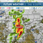
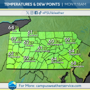
Unfortunately, the immediate future holds thunder storm chances and a significant wind damage risk. A possible isolated tornado in the Northwest cannot be ruled out as well. Expect rain to begin this afternoon into the evening hours, bringing strong winds and even a risk for hail. Temperatures will remain above 60 for tomorrow as the severe weather moves out of the area.

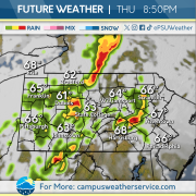
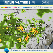
For the next couple of days expect more thunderstorm chances for Thursday, with a scattered rumble of thunder and lightning possible. Temperatures will rebound to the mid seventies along with the severe weather. Rain chances persist well into Friday before clearing up in time for the weekend.

You can BET May will start WET

This past weekend, showers dissipated early in the day Saturday, but clouds remained throughout the day. Some gusty conditions were present as temperatures dropped off in the evening. Cloud coverage decreased early on Sunday, and abundant sunshine overtook the state.

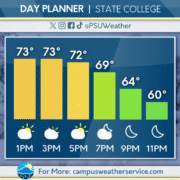
A chillier beginning to the day today with most of the Commonwealth looking at temperatures in the 40s. But these cooler morning temps will rise later into the afternoon reaching a high of 73 degrees that will fall down to 52 degrees tonight.

Tomorrow, expect some thunderstorms to roll into the area bringing wet conditions, though with temps well above average. Wednesday will be similar to today, with some clear skies and high temps before a rainy and cool weekend ahead.


Sunshine, Sunshine, Rain!

To begin this past week, a cold front traversed the state on Monday bringing below average temperatures and rainfall. Conditions remained cooler and windy on Tuesday before a warmup Wednesday into Thursday.

For today, rain showers pass through the Commonwealth with chance of thunderstorms overnight. Tomorrow, rain showers continue through the early morning before clearing up in the afternoon. Overcast skies expected before sunshine dominates the region on Sunday.

To begin the workweek, Spring-like conditions continue on Monday, before rain showers return Tuesday afternoon and depart on Wednesday.

Spring is in Full Force!

Temperatures have steadily increased into the 70s during the past couple of days, which is above average for this time of year.  We have also had partly cloudy to mainly sunny skies throughout the week.  Overnight we had clear skies with temperatures in the 40s as we have another warm day on tap.

This afternoon, sunny skies are on the way as a high pressure system continues to take control over the region.  Temperatures will soar into the upper 70s across the state today.  However, conditions look to change tomorrow and into the weekend as we will see an increase in cloud cover and some rain showers due to a low pressure system passing through the state tomorrow night.

The rain showers will clear out by Saturday afternoon, and we will have pleasant conditions for Sunday in the upper 60s.  Next week we will see another rise in temperatures into the 70s and even the 80s.  Mainly sunny skies will the theme for the beginning of the week, but clouds will start to build again during the second part of the week.

Keeping It Springy

Temperatures over the past few days have climbed back up to around average for spring. We saw a few showers pass through the state yesterday, but still kept temperatures above average heading into today. Conditions improved overnight as we were left with just a few clouds and warmth this morning.

Heading into the afternoon, conditions will improve as clouds begin to depart as high pressure will settle over the state. Temperatures will climb into the mid 60’s later today and continue to warm heading into tomorrow afternoon. Over the coming days, we’ll look to reach into the 70’s, but the return of rain is in the works.

Friday evening and night will bring a few showers into the area. By Saturday, those showers will clear out and we’ll be back down in the 60’s for the weekend. Conditions will continue to stay warm heading into the next work week.

Spring has sprung, and the warm has begun.


It’s finally starting to feel like spring in State College, with above average temperatures dominating the commonwealth over the weekend. Sunny skies and warm conditions made itself known this weekend as we saw temperatures in the 80s on Saturday, and 70s on Sunday.

Today brought in some more clouds, with light gusts and temperatures closer to average in the lower 60s.

These spring-like conditions will carry-on throughout this week, with temperatures consistently in the upper 60s and lower 70s. April showers will also make their way into the area, bring some rumbles of thunder Monday afternoon and evening. Apart from the rain tonight, it will be a sunny, warm week before another chance of rain this Saturday.

Hopping into Easter Weekend

This past week we experienced windy and rainy conditions throughout the week. Overcast skies dominated the region while bringing spring like temperatures back to the commonwealth. Wednesday saw temperatures drop below seasonal averages before climbing back up to prepare for the weekend.

High temperatures continue to prevail, however Saturday scattered showers with stronger wind speeds and chance of thunderstorms interrupt this warmer pattern. Rainy Conditions are expected to begin in the mid afternoon and continue overnight before departing for Easter Sunday. Sunday conditions are pleasant, with higher temperatures and decreasing wind speeds.

Early on in the workweek, scattered showers traverse through the commonwealth before more favorable conditions on Wednesday and Thursday. There is a chance of some rainstorms towards the latter end of the workweek and continuing into next weekend.

Temperatures on the Rise in PA

The past 24 hours brought cold, windy weather to the Commonwealth, but that won’t be sticking around for long.  Mother nature is about to flip the switch to a more spring-like pattern, ending the period of below average temperatures that we’ve seen during the past several days.

Currently, we are in the midst of a warmup from the cooler temperatures we’ve been seeing over the past couple of days. Today will be sunny as we return to near average temperatures for this time of year. Winds will be gusting slightly but not as much as we’ve seen over the past couple of days.

Looking ahead toward tomorrow and the weekend, the gradual increase in temperatures will continue. Conditions are expected to be mostly cloudy for tomorrow and Saturday, but some peeks of sun can’t be ruled out. Tomorrow, there will be some gusty winds across the state that begin to die down as we get into the later part of Saturday.

One Commonwealth, Two Temperature Profiles

Yesterday saw unprecedented warmth compared to recent trends, with the high temperature here in State College hitting 70 degrees on the dot. Adding to the spring like conditions, mostly clear skies persisted throughout the day with the only precipitation event occurring in the overnight hours. A pleasant day for fans of warmer temperatures and sunny conditions.

For the next 24 hours, the shift in temperatures gets more dramatic as you move from west to east. The western side of the Commonwealth is over 10 degrees cooler than 24 hours ago, and the east is over 10 degrees warmer than 24 hours ago. Expect Central Pennsylvania to lean towards the colder side as we move through the day Tuesday into Wednesday.

A farther look into the future reveals chances for both rain and snow showers, the latter coming into play late tonight into tomorrow morning. Expect the former to show itself briefly tonight but show its true force this weekend with high chances for rain showers present.

Rain, Rain, Go Away… Don’t Come Back Another Day!

Fun fact: It’s rained for the past twelve days!

This past weekend, we saw some miserable weather on Saturday. Daytime temperatures hovered in the 40s throughout the day, and precipitation was limited to mist and drizzles. Things turned around on Sunday when the commonwealth received mainly sunny skies and highs reaching up to 60 degrees.

Although much of the state is cloudy now (thanks to a brief bout of rain overnight), higher temperatures will continue throughout the day today. There will be a high of 61 today, but later tonight there is a chance for showers, and potential thunderstorms, especially to the South.

The cold front associated with these storms will cause temperatures to fall tomorrow. A late-night wintry mix is possible and wind gusts could reach up to 45 mph. After Tuesday, temperatures will again be chilly, with lake-effect snow showers possible across the Erie lakeshore.