Foggy Mornings Followed by Sunny Afternoons


Weather over the past few days in State College has started off noticeably cooler in the mornings as fall begins to set in. Temperatures have warmed throughout the day, however, bringing about comfortable conditions for outdoor activities.

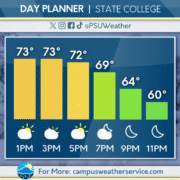
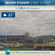
Today’s weather has been relatively similar, with temperatures climbing slightly higher. Some clouds linger over the area due to a low pressure system off the New Jersey coast. Tonight, temperatures will dip down into the 50s, making for a cool night.

Over the next few days, valley fog can be expected in the mornings, clearing as daytime heating kicks in. Expect sunny skies with a few clouds occasionally making an appearance. Overall, the coming days should be clear, giving an enjoyable start to the weekend.
Pleasant Transition Nearing Fall Conditions

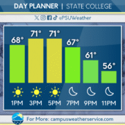
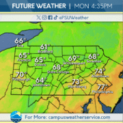
The dry and comfortable conditions today will persist throughout the week. This past weekend we had some moisture move through the area due to a cold front, causing scattered rain and cloudy skies on Saturday. As this moved out of the area, high pressure quickly took over, causing dry and pleasant conditions on Sunday and Monday.  This high pressure system will be keeping sunny skies and low humidity in and around the Commonwealth. Temperatures are expected to warm up through the weekend, with more clouds possible later this week.

Looking Ahead at a Dry and Cool Week

Following the exit of Saturday’s cold front that brought rain to much of the Commonwealth, a fall-like pattern has set in. Crisp conditions, clear skies, and temperatures slightly below average were the result of high pressure to round out the weekend.

Today’s weather is much the same. Notably, frost advisories were issued by the National Weather Service for early Monday morning as the region saw a marked plunge in temperatures overnight. Clear skies and continued high pressure ensure that conditions will remain much like Sunday’s, with temperatures generally topping out just below the 70-degree mark. Precipitation is nowhere to be found, and our dew points will remain quite dry.

The rest of the week, quite frankly, is rinse-and-repeat. High pressure lingers, and a pattern of nearly cloudless skies, relatively cool temperatures, and comfortably dry air will make for a week full of hints of the coming fall season.

Rainy Conditions For Gameday

A cold front pushed its way through Central Pennsylvania yesterday bringing showers and cooler weather. Pop up showers were prevalent across the Commonwealth through the evening hours. Conditions cleared overnight as the system moved along.


Temperatures in the 70s to low 80s are in the forecast for Friday across much of Pennsylvania. Along with the higher temperatures, expect abundant sunshine for a summer-like feel. Rain will make its return tonight and stick around through early tomorrow morning.


The outlook for this weekend includes rain showers and cooler temperatures via a second cold front approaching. Expect the peak of the rain to occur around kickoff on Saturday. so make sure to bring a rain poncho if you plan on attending the game. Sunday will see a clearing in conditions, giving way to a sunny start to next week.

Storminess Returns Before Mid September Cool Down

After a return to seasonable temperatures on Wednesday, with mostly clear skies throughout the Commonwealth, big changes are on the way for the middle of September. After a chillier start to the week, Wednesday marked a return to some normalcy, with temperatures peaking in the low 80s.

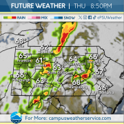
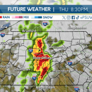
Thursday will be slightly cooler, with high temperatures in the mid to upper 70s, but with that change in temperature, comes the chance for showers and thunderstorms. The Storm Prediction Center has placed most of Pennsylvania in a level 1 out of 5 severe thunderstorm risk, as a line of showers and embedded thunderstorms moves from west to east this evening.

After another round of showers and storms Friday into Saturday, temperatures will dive well below our averages for this time of year. High temperatures later this weekend and into early next week will stay in the upper 60s to low 70s, about 5 degrees below normal.


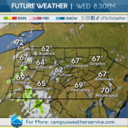
Mid-week weather continues with Wednesday remaining mostly clear for most of the Commonwealth throughout the day. As the evening approaches, our next system starts to roll in with clouds and showers starting to make their way into the Southern and Western parts of the state.

Thursday brings the chance for severe thunderstorms as a cold front sweeps its way through State College and the rest of the Commonwealth.

This weekend brings cooler temperatures once the cold front moves through, with temps hovering around 70 degrees into the weekend.

Dry Spell Ends Later This Week!

This past Labor Day Weekend kicked off meteorological Fall with below average lows in the 40-degree range. As well as moderate conditions, with very few clouds.

For today, we will experience more seasonable conditions with highs in the 70s and lows in the mid-to-upper 50s. Dry and mostly sunny conditions will trend into Wednesday, as well.

A cold front will approach on Thursday causing for plentiful rain around the Commonwealth. Rainy conditions should clear out, for a much milder Friday. For this weekend, a secondary cold front will approach causing for rain on Saturday.

Rain, Rain, and More Rain!

This past week we experienced a derecho event on Tuesday evening, causing damages and left thousands without power across the commonwealth. The rain took a break Wednesday, until returning again Thursday evening with thunderstorms traversing across the state.

Today,  partly sunny skies and warmer conditions reign until rain with chance for scattered thunderstorms returns in the mid to late afternoon.  The washout continues on Saturday with rainy skies and chances of  thunderstorms throughout the day. These continues remain for Sunday.

To start the workweek, more rain dominates the skies throughout Monday, Rain continues on Tuesday with a chance for conditions to break. These conditions continue through Wednesday before clearing out for the remainder of the workweek.

Rounds of Storms Continue

It seems like we just can’t get a break from these… April storms? Instead of showers, we’re in store for another day of active weather. We just saw a line of strong storms move across the state on Tuesday, but we’re slated for yet again another potentially severe evening.

Storms should hold off through the afternoon, leaving us with warm and sunny conditions. Storms will move in later this evening and night, bringing the chance for strong winds and heavy downpours. Be weather aware today and be precautious; stay inside and report damage after the storm has moved through.

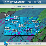
The wet weather doesn’t stop there however. The chances for rain and storms does not dissipate as we head into the weekend. Friday, Saturday, and Sunday all have the potential to create washout conditions, especially Saturday. Heading into next week, those rain chances will still be sticking around.

A Week Bookended by Storminess

A line of thunderstorms traversed the Commonwealth on Tuesday, knocking out power to over 500,000 customers. Wind gusts over 60 miles per hour were recorded from the Ohio state line through central Pennsylvania, before the line weakened in the eastern third of the state. Temperatures behind the line dropped over 30 degrees in some spots, as the cold front moved through.

High pressure worked its way into the Commonwealth Wednesday morning, bringing with it mostly clear skies and lower dew points. These dry and calm conditions will be short lived, as another round of storminess is set to impact Pennsylvania to close out the work week.

Showers and likely on Thursday with a chance for some embedded rumbles of thunder. Unsettled weather will persist into Friday and the weekend, becoming less widespread as time goes on. This unsettled stretch will end on Sunday with a return of mostly clear skies continuing into next work week.