March Showers Bring April Sours

Today marks the end of a cold, sunny, and windy week.  The last of Winter weather was seen on Wednesday where parts of the Commonwealth saw a wintry mix during the morning.  On Thursday, the region experienced a gradual warm-up throughout the day, aided by beautiful sunny skies.

This weekend will see early blossoms of Spring as temperatures climb well above average.  A chance for spotty showers will remain possible on Friday, clearing out into Saturday.  Sunday will see our next chance for a widespread precipitation maker.

April begins wet and seasonable before a blast of cold air moves in the early hours of Tuesday.  Chillier temperatures settle into the Commonwealth throughout much of next week, with another chance for showers likely later in the week.

Weekend Warmup (and Washout?) Expected

Yesterday brought an unwelcome sight for much of Pennsylvania, with many seeing their first flakes in a couple weeks. The much cooler temperatures are a noticeable change from the last week or so, with below freezing temperatures overnight for much of the state. Despite the cold, skies cleared out very well overnight across the state.

Fair weather is expected today, with sunny skies during the day and a slight (but welcome) warmup compared to yesterday. Despite starting the day off near or below freezing, many areas will warm into the 50s in the afternoon. Clouds will likely increase overnight.

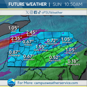
An active weather pattern is expected going into the weekend, with a light initial round of rain associated with a warm front moving through Friday afternoon. The entire state will be much warmer than average for the weekend, with widespread 60s and 70s for both Saturday and Sunday. However, rain will also be widespread, particularly Saturday night, Sunday evening, and Monday, with thunderstorms possible in the southern parts of Pennsylvania as a cold front moves through Monday afternoon.

Clouds… thickening up?

We have been experiencing warmer temperatures the past couple weeks, making it feel more springlike. This weekend, mild conditions with near average temperatures dominated the area. Rain showers Sunday night left cloudy conditions lingering Monday morning.

Drier conditions today with temperatures climbing up to the mid 50s. Strong winds move into the area throughout the day, with gusts up to 30mph.

Our next system moves into the area tomorrow night, bringing the potential for rain and snow showers later this week. Expect temperatures to be lower than average in the following days.

Windy Weekend

A huge shift has occurred for the Commonwealth as temperatures dip back down to below average. A cold front that moved through on Thursday afternoon brought chillier temperatures as well as rain showers to much of the region. The remaining precipitation moved through the Eastern portion of the state late Thursday into Friday morning, making way for clear skies to start the weekend.

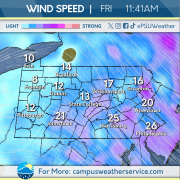
Friday morning saw close to freezing temperatures in the wake of the cold front that moved through, leaving behind gusty winds but sunny skies. Winds will begin to calm throughout the rest of the day on Friday. These pleasant conditions will not stick around for long as the next chance for precipitation quickly approaches during the rest of the weekend.

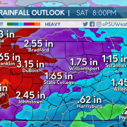
A chance for spotty rain showers will be the case for much of the Commonwealth on Saturday, with temperatures remaining close to or below average. Sunday will begin calm and dry before transitioning to wet and chilly as a low-pressure system moves through during the overnight. This pattern of wintry mix and cold temperatures will be the case throughout much of the last week of March.

Cooler Temperatures Amidst Some Rain Showers

The past week has seen a gradual warming of temperatures. Temperatures have been consistently comfortable over the past few days with highs consistently in the upper 60s and lower 70s. Yesterday brought temperatures in the low 70s with windy conditions across the state.

Today we can expect high temperatures in the low 60s and high 50s across the state. A cold front will move across the state during the late morning and afternoon hours. This will drop temperatures across the Commonwealth with lows across the state in the high 20s and low 30s. Rain showers are expected across the region.

These cooler conditions are expected to stick around for the foreseeable future with highs expected in the low 50s for the weekend. A brief shot of rain is expected on Saturday through portions of the state. Monday will see a system move through that will bring rain to the entire state.

Spring Conditions Across the Commonwealth

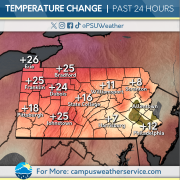
We are just a day away from the start of astronomical spring and things have already felt spring-like. In the past 24 hours, Central Pennsylvania has experience a drastic change from the past couple of week. Yesterday was notable for its sunny and warm conditions. Temps were characterized as above average, making for a great day of outdoor activity.

For the next 24, a shift in temperatures is expected with conditions staying below the 60 degree mark. Additionally, rain is expected to arrive and remain for most of the day. Tomorrow will end up looking different than what we have seen in the past couple of days.

A quick peek at the end of the week reveals more chances for rain as we enter the weekend. Expect rain on Saturday with the potential to change over to snow in some areas. Snow, if any, is not expected to accumulate and will be smaller flakes. Monday of next week will see even more rain that will be impact as its duration will be all day. Make sure you are prepared when you leave for work or school.

Feeling Like Spring Again… For Now

Over the weekend, we saw some severe thunderstorms move through the Commonwealth, bringing strong winds and even a few isolated tornadoes to spots in western PA. After the front moved through, temperatures declined and remained low headed into Monday. Clouds overtook the region as well, preventing any sunshine to help raise temperatures.

Unlike Monday, the next few days look to be very promising regarding the temperature department. Highs for Tuesday and Wednesday are slated to hit the 60 degree mark. With no clouds in sight, conditions will stay dry and above average until Wednesday night, when we’ll start to see clouds roll in ahead of our next weather maker.

Thursday will bring some clouds and rain for the entire state, with the chance for some snow over portions of eastern PA. Those above average temperatures take a slight dip, stretching into the mid 50’s Thursday before really cooling off into the 40’s heading into Friday and the weekend. If you’re a fan of the above average temperatures, don’t fret, because we’ll be hanging around the 50 degree mark heading into next week.

Have No Fear…Spring is Here

Most of the commonwealth was affected by a line of severe weather yesterday, bringing damaging winds and hail across the state. State College reported trees down, widespread power outages, and small hail. The storms were associated with a larger cold front that marched across the state throughout yesterday afternoon.

While yesterday was unusually warm across much of the Commonwealth, the cold front brought much cooler temperatures today. Temperatures across the State College area and much of the Western half of the state are up to 30 degrees cooler today than they were yesterday. Conditions will be dry throughout the remainder of the day.

However, Spring will make a return tomorrow and throughout the rest of the week, as temperatures rise to well above average during the mid-week. Warm temperatures and dry conditions will make for beautiful weather tomorrow and early Wednesday before rain threatens to invade later in the week.

Pennsylvania Wields Windy Woes


This week, we experienced warmer conditions and a couple bleak days of overcast skies. Early in the week there was a rain event that brought precipitation to much of Pennsylvania.

Today, while temperatures loom in the 40s, feels-like conditions are a lot chillier due to high wind speeds across the Commonwealth. Tomorrow, temperatures continue to drop as a cold front traverses the state. With the cold front, chances of snow are increased in the western regions.

Next week pleasant conditions for Monday and Tuesday as sunny skies prevail. Overnight Tuesday into Wednesday a new system enters the region bringing rain throughout. Early Thursday as temperatures drop to seasonal averages, western portions of the state receive a higher chance of snow showers.


Another Ride On The Temperature Rollercoaster

Across the Commonwealth, temperatures have been slightly above average with mostly sunny conditions. We saw a few rain showers move across the region on Wednesday. Clouds rolled in overnight as the next small system gears up to sweep across the state.

Today, temperatures will continue to be slightly above average before quickly dipping tomorrow and into the weekend. Currently, conditions across the state remain calm except for a few rain showers that will continue into the night. Precipitation is expected to be light with potential snow flurries in the higher elevations.

Tomorrow, expect temperatures to drop slightly. The next system begins moving into the area early Saturday and has the potential to bring more snow and rain showers into our region. Heading into the next work week, conditions will stay dry but chilly as we await our next warmup, which is expected midweek.