
CWS Forecast: Northwest Pennsylvania
After a dry Saturday, this week will bring wet conditions to the Commonwealth. Saturday will bring high cloud cover, and cold dry air coming from the north, with rain beginning overnight. Sunday is expected to have steady rain across the state with possible thunderstorms overnight. Some model guidance points to continued rain on Monday throughout Southern Pennsylvania as well. Even more steady rain is expected on Tuesday and Wednesday with below average temperatures.
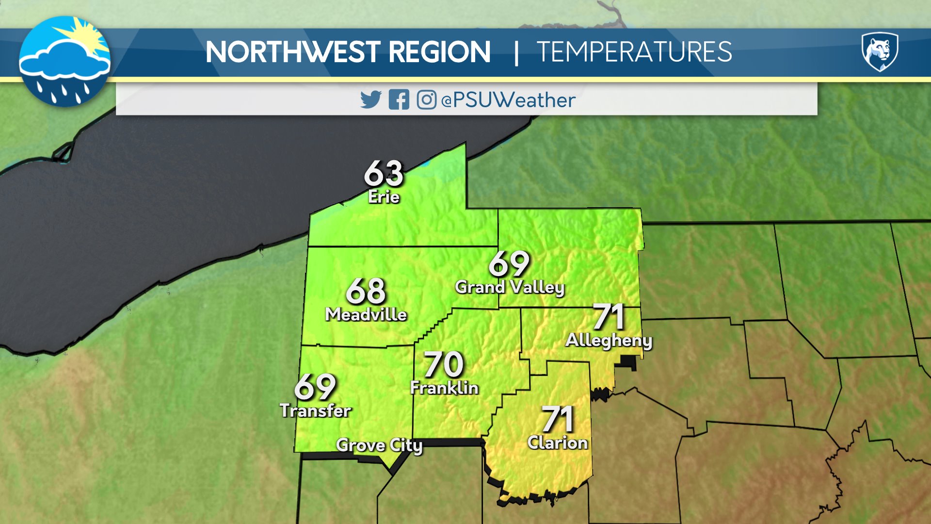
Day One: Sunday, September 20th 2026
Overcast with less humidity. Chance of stray showers overnight.
High: 70°F
Low: 59°F
Day Two: Monday, September 21st 2026

Rain and scattered storms with a chance of severe weather through the afternoon. Humidity returns but temperatures stay low.
High: 67°F
Low: 61°F
Day Three: Tuesday, September 22nd 2026
Mostly cloudy but drying out. Comfortable as temperatures drop further. Overcast by night.
High: 64°F
Low: 55°F
Day Four: Wednesday, September 23rd 2026
Staying overcast with a chance of rain. Temperatures staying below seasonal averages.
High: 62°F
Low: 53°F
Day Five: Thursday, September 24th 2026

Overcast with scattered showers. Temperatures remaining low. Clouds beginning to break overnight.
High: 64°F
Low: 53°F

